- 28, Nov 2025 | Khilak Budhathoki
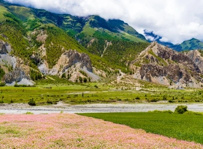
The Manaslu Circuit Trek is one of Nepal’s most varied Himalayan routes for landscape, cultural, and documentary photography, following the Manaslu massif from lower river valleys and terraced hillsides to the high-altitude terrain around Larkya La Pass at 5,106 meters. A single journey brings photographers into subtropical forests, Tibetan-style villages, Buddhist monasteries, alpine pastures, glacial valleys, turquoise mountain lakes, high-desert landscapes, and close views of Mount Manaslu (8,163 m) and surrounding Himalayan peaks. The changing elevation and terrain create distinct photographic subjects throughout the route, from village life and prayer flags to glaciers, mountain reflections, dramatic ridgelines, and the Manaslu icefall.
Strong photography on the Manaslu Circuit depends on more than reaching scenic viewpoints. Light, weather, wind, altitude, trekking schedules, acclimatization days, and side excursions determine when each location is most productive for photography. Early morning can provide calm reflections at Birendra Lake and clear mountain light, while late afternoon can transform Bhimtang Valley and the high-desert terrain around Samdo with warmer side-light. This guide examines the seven best photography spots on the Manaslu Circuit Trek, explaining what each location offers, the best time and conditions for shooting, and how to plan a photography-focused itinerary that makes the most of the route’s landscapes, culture, and changing Himalayan light.
1. Larkya La Pass (5,106 m)
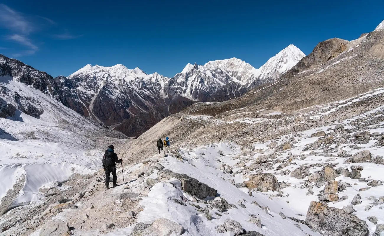
Larkya La marks the highest point of the entire trek and the moment the route crosses from the Manaslu side of the range into the Annapurna side. Every trekker passes through here regardless of itinerary, so the pass carries no optional detour cost for photographers. Ice, rock, and prayer flags dominate the immediate terrain, with almost no vegetation left at this altitude. The crossing demands an early departure and cold-weather readiness, so gear preparation matters as much as composition here.
What Can You Photograph From Larkya La Pass at 5,106 Meters?
Larkya La Pass delivers a 360-degree high-altitude panorama including Himlung Himal, Cheo Himal, Gyaji Kang, Kang Guru, and Annapurna II, framed by prayer flags and glacial ice on the pass itself. This is the trek's single highest and most technically demanding viewpoint, crossed on day nine or ten of most itineraries. The pass sits at the boundary between the Manaslu and Annapurna conservation areas, so it delivers views into two separate mountain systems from one location, something no other point on the route offers.
The immediate foreground at the pass, strings of weathered prayer flags anchored in rock and ice, gives every wide shot a human element without requiring a person in frame. Snow cornices along the ridge change shape week to week, so no two crossings produce an identical composition. What competitors' guides tend to skip is the descent side toward Bimtang: the first thirty minutes past the pass offer a rear-facing view back at the flags and ridgeline with the rising sun behind them, a shot that's lost if you don't stop and turn around.
How Can You Capture Sunrise and Mountain Views From Larkya La Pass?
Departing Dharamsala (also called Larkya Phedi) between 4:00 and 4:30 a.m. positions photographers at the pass for direct sunrise light on the surrounding peaks, typically between 6:00 and 6:30 a.m. depending on the month. This pre-dawn start is standard practice for the crossing regardless of photography goals, meaning the daily departure timing works naturally in a photographer's favor, even though dedicated shooters should still add a buffer day to their overall schedule for weather delays.
Temperatures at the pass commonly sit between -15°C and -25°C before sunrise, so battery drain accelerates fast. Carrying a spare battery in an inner jacket pocket, not in the camera bag, keeps a backup warm and ready. Headlamp-lit trail shots on the ascent, taken before the sky lightens, capture the line of climbers against the dark ridgeline and work well as a scale reference for the scene that follows. In real-world use, a mid-range aperture around f/8 with a tripod or trekking-pole brace handles the low pre-dawn light better than pushing ISO high, since wind at the pass makes long handheld exposures unreliable. Gloves-off shooting time should be kept short and deliberate; frostbite risk on exposed fingers at this altitude is real, and most experienced trekking guides recommend composing the shot with gloves on and removing them only for the shutter press.
2. Birendra Lake (3,691 m)
Birendra Lake sits below Manaslu Base Camp and forms one of the trek's few genuine still-water viewpoints. Glacial melt feeds the lake directly, giving it a turquoise tone rarely seen elsewhere on the route. The short walk from Sama Gaun makes it accessible on an acclimatization day without adding real trekking distance. Wind picks up quickly after sunrise, so the calm-water window here closes faster than at most other stops.
What Mountain Reflections Can You Capture at Birendra Lake?
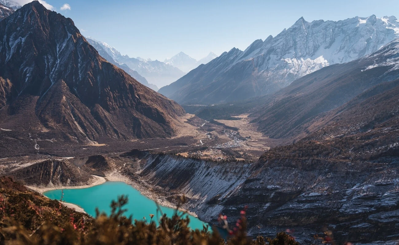
Birendra Lake, a glacial lake below Manaslu Base Camp near Sama Gaun, reflects Manaslu's south face and surrounding ridgelines on calm mornings, producing the trek's most reliable mirror-image mountain shot. The lake sits roughly a 90-minute round-trip walk from Sama Gaun, making it accessible as an acclimatization-day excursion rather than a full trekking day, which is why most itineraries already build in a rest day here.
The lake's turquoise color, caused by suspended glacial rock flour, contrasts against the white summit ridge above it, and this color separation is strongest in direct but not harsh light. A short scramble along the lake's eastern shore, away from the main viewing point most groups stop at, opens up a composition with fewer footprints in the foreground moraine and a cleaner sightline to the reflection. What most visitors overlook is that wind picks up at this elevation by mid-morning, breaking the reflection within an hour or two of sunrise, so the shooting window here is genuinely narrow.
When Is the Best Light for Photographing Birendra Lake?
The 30 minutes immediately after sunrise, before wind disturbs the water surface, produces the sharpest reflections at Birendra Lake, typically between 6:30 and 7:30 a.m. depending on the season. Arriving at the lake before this window, while the light is still soft and blue-hued, allows time to set up a composition and wait for the first direct sun to strike the summit, a moment that lasts only a few minutes but defines the shot.
Overcast mornings, common in the shoulder seasons, actually help here rather than hurt: flat light removes the harsh reflection glare off the water surface and can produce a more even, painterly rendering of the mountain's texture. A polarizing filter cuts glare on the water surface during bright, direct-light mornings and deepens the sky's blue behind the summit, a small piece of equipment most trekkers leave out of their kit but genuinely earns its weight on this specific shot.
3. Lho Village (3,180 m)
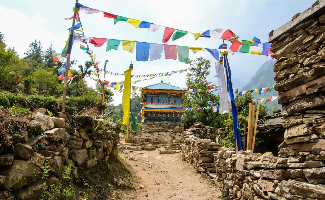
Lho sits low enough on the route that cold and altitude fatigue rarely interfere with careful composition work. The village's whitewashed Ribung Gompa gate frames Manaslu with no ridgeline in between, a rare direct sightline at this elevation. Daily life continues visibly through the lanes, with prayer wheels, livestock, and woodsmoke all part of the working village. This combination of culture and mountain backdrop makes Lho one of the trek's most complete single-location shoots.
Which Himalayan Peaks Can You Photograph From Lho Village?
Lho Village offers an unobstructed direct view of Manaslu framed above the white Ribung Gompa monastery gate, one of the most photographed compositions on the entire route. The monastery's whitewashed gate and prayer-wheel walls sit on a ridge just above the village, and Manaslu rises directly behind them with no intervening ridgeline, a rare unobstructed sightline this low in elevation.
Peak 29 (Ngadi Chuli) becomes visible from slightly higher points around the village, giving photographers a two-peak composition without leaving the settlement. Because Lho sits at only 3,180 meters, well below the altitude where cold and fatigue start limiting shooting time, this village allows for slower, more deliberate composition work than the higher stops on the route.
How Can You Capture Traditional Village Life in Lho?
Morning hours between 7:00 and 9:00 a.m. capture Lho's daily rhythm: villagers turning prayer wheels at the monastery gate, yaks and dzo moving through narrow stone lanes, and smoke rising from kitchen chimneys against the mountain backdrop. This window aligns with when the village genuinely goes about its routine, rather than being staged for visitors, which produces more honest documentary-style images.
Common mistakes here include photographing people without asking first. A brief greeting and a gesture toward the camera, even without shared language, is standard practice and is respected by villagers who are used to trekkers passing through. Monasteries and prayer wheels carry religious significance, and clockwise walking direction around them should be maintained even while shooting, both as a matter of respect and because it naturally guides a photographer around the subject for varied angles. Late afternoon light, arriving low and warm through the village's east-west lane orientation, works well for architectural detail shots of carved window frames and prayer-flag-strung rooftops.
4. Samdo (3,875 m)
Samdo is the last major settlement before Larkya La and the point where the landscape shifts from forest to high desert. Houses cluster tightly against the wind, giving the village a fortress-like profile against the open terrain. The Tibetan border lies close enough that the surrounding ridgelines feel like a different country entirely. A second acclimatization day here gives photographers rare unhurried time at this altitude, unlike the pass-crossing days ahead.
What Mountain Scenery Can You Photograph Around Samdo?
Samdo, the last major village before Larkya La, sits in a high desert bowl with views toward the Tibetan border, Samdo Peak, and a wide amphitheater of unnamed 6,000-meter ridgelines. The village's fortress-like layout, houses clustered tightly for wind protection, reads dramatically against the barren, near-treeless terrain surrounding it, a landscape that shifts abruptly from the forested lower valley within a single day's walk.
A ridge above the village, roughly a 45-minute climb used for acclimatization, opens a panoramic view back down the valley and forward toward the Tibetan plateau, one of the few points on the trek where the border region itself becomes part of the composition. What competitors' content tends to skip is the color of the terrain itself: the ochre and rust-toned rock around Samdo, uncommon elsewhere on the route, photographs strongly in the low-angle light of early morning and late afternoon.
How Can You Capture the High-Altitude Landscape of Samdo?
Wide-angle compositions that include the village's stone architecture in the foreground against the open, treeless valley behind it communicate scale better than mountain shots alone at Samdo. Because vegetation disappears almost entirely at this elevation, depth cues in a photograph come from layered ridgelines and atmospheric haze between distance planes rather than from trees or foreground greenery, so shooting during the golden-hour window, when low sun rakes across the terrain and separates those layers with shadow, matters more here than at lower villages.
Samdo also functions as the trek's second acclimatization stop, and the extra day here allows for a genuine sunrise shoot from the ridge above the village without needing to break camp early, unlike the pass-crossing days where sunrise photography is bound to a fixed departure schedule. Wind and cold increase noticeably at this elevation compared with Lho, so the same battery and glove management practiced at Larkya La applies here as well, just at a slightly less extreme scale.
5. Shyala Village (3,500 m)
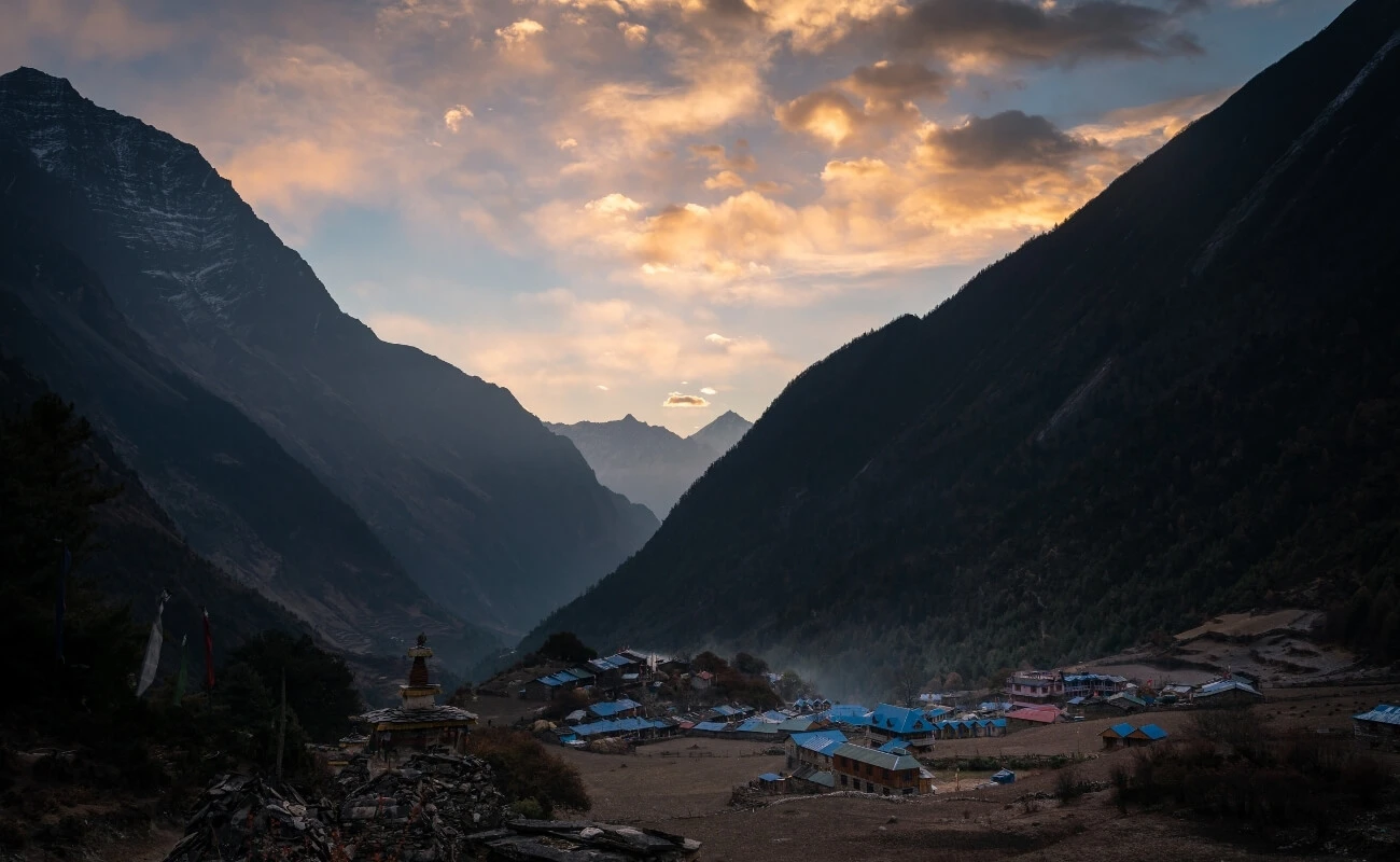
Shyala opens onto wide pastureland rather than the tighter village layouts found lower on the trail. Manaslu, Manaslu North, and Naike Peak all sit visible from the same open ground. Grazing yaks and scattered chorten monuments give foreground options that most other stops on the route lack. Many trekkers pass straight through toward Sama Gaun, leaving this open stretch underused for photography.
Which Manaslu Mountain Views Stand Out From Shyala?
Shyala Village opens onto one of the widest unobstructed mountain panoramas on the route, with Manaslu, Manaslu North, and Naike Peak visible together across open pastureland. Unlike Lho, where the monastery frames a single peak, Shyala's approach walks through open meadow, giving photographers room to work with foreground elements such as grazing yaks, chorten monuments, or prayer-flag lines without a tight village layout constraining composition.
The short walk between Shyala and Sama Gaun runs through some of the trek's most open terrain, and this stretch, rather than either village itself, often produces the strongest wide-panorama shots because it offers unobstructed sightlines in every direction. What most itineraries treat as a transit section between two overnight stops is, for photography purposes, a destination in its own right.
How Can You Photograph Shyala Village and Its Surroundings?
A mid-morning arrival at Shyala, after the low valley haze has cleared but before afternoon cloud builds against the peaks, gives the clearest window for capturing the village against its mountain backdrop. Stone-walled fields and grazing livestock in the foreground add scale to wide shots of the Manaslu massif; positioning these elements in the lower third of the frame, with the peaks filling the upper two-thirds, is a compositional approach that performs consistently well here given the openness of the terrain.
Because Shyala sits on the direct route to Sama Gaun and Manaslu Base Camp, many trekkers pass through without stopping, moving straight on toward the acclimatization stop ahead. Budgeting even 30 to 45 minutes here, separate from the base-camp excursion, captures a village-and-mountain composition that the busier Sama Gaun viewpoints don't offer in the same open, uncluttered form.
6. Bhimtang Valley (3,720 m)
Bhimtang is the first stop after Larkya La and marks a clear shift in terrain from the barren pass to a flat glacial valley. Braided river channels and scattered juniper scrub replace the ice and rock of the crossing itself. Manaslu's western face, along with Himlung Himal and Cheo Himal, remains visible across the open valley floor. The wetter Annapurna-facing side of the range tends to bring more stable weather than the approach to the pass.
Which Peaks and Landscapes Can You Capture in Bhimtang Valley?
Bhimtang Valley, reached on the descent from Larkya La, offers views of Manaslu's western face, Himlung Himal, Cheo Himal, and Pongkar Glacier across a wide, flat glacial valley floor. This is the first settlement after the pass crossing, and the terrain here differs sharply from the high-desert Samdo side: glacial moraine, a braided river system, and scattered juniper scrub replace the barren approach to Larkya La.
The valley's flatness, rare on a trek defined mostly by steep terrain, allows for compositions with genuine leading lines: the braided river channels draw the eye directly toward the peaks beyond. Pongkar Glacier, visible on a short side excursion from the main village, adds ice-formation detail shots that don't appear elsewhere on the standard route, since most of the trek's glaciers are viewed from a distance rather than approached directly.
When Can You Photograph the Best Views Around Bhimtang?
Late afternoon, arriving after the pass crossing, catches warm side-light across the valley floor and Manaslu's western face just as the day's trekking group settles in, typically between 3:00 and 5:00 p.m. Because most trekkers reach Bhimtang exhausted after a demanding pass day, this golden-hour window is frequently missed entirely; a short, deliberate walk to the edge of the village immediately after settling into a guesthouse, rather than resting first, captures light that disappears within the hour.
Morning conditions here run cold and often frosted, since the valley sits in shadow from the surrounding ridgeline until mid-morning, but frost-covered scrub and river ice in the low, indirect blue light of early morning produce a different, quieter mood than the golden-hour shots and are worth the ten minutes outside before breakfast. Weather stability tends to improve noticeably once past the pass, since Bhimtang sits on the wetter, Annapurna-facing side of the range, giving photographers a slightly more forgiving window than the exposed Samdo side.
7. Pungyen Gompa (~4,000 m)
Pungyen Gompa requires a dedicated half-day detour from Sama Gaun, which keeps trekker numbers here far lower than at the main route stops. The trail climbs directly toward Manaslu's eastern flank, closing the distance to the mountain more than anywhere else on the circuit. Seracs and avalanche debris on the icefall become individual, visible details rather than distant texture. The monastery remains an active site of worship, so the same respect shown at Lho applies here as well.
What Himalayan Views Can You Capture From Pungyen Gompa?
Pungyen Gompa, a side excursion from Sama Gaun, sits directly beneath Manaslu's eastern flank, offering one of the closest unobstructed views of the mountain available anywhere on the route. The monastery's remote position, roughly a half-day round trip from Sama Gaun on a trail most groups skip in favor of the base-camp route, means far fewer trekkers reach it, and the compositions here carry a quieter, less-photographed quality than the trek's more frequented viewpoints.
The trail to Pungyen climbs through rhododendron and juniper before opening onto exposed moraine directly facing Manaslu's icefall, close enough that seracs and avalanche debris become visible individual features rather than distant texture. What most trekking itineraries skip entirely, since it requires a dedicated half-day rather than a stop along the main trail, is this direct icefall perspective, arguably the single most dramatic close-range mountain view on the entire circuit.
How Can You Photograph the Monastery and Mountain Landscape?
Framing the gompa's prayer flags and weathered stone walls in the foreground against Manaslu's icefall in the background captures both the cultural and geological character of this location in one composition. The monastery itself, still an active site of worship, should be photographed with the same respect applied at Lho: quiet observation, a request before photographing monks or ceremonies, and clockwise movement around religious structures.
Because this excursion adds a half-day to the itinerary, it works best scheduled on the Sama Gaun acclimatization day. To capture both Birendra Lake and Pungyen Gompa, photographers should shoot the lake's reflection right at sunrise, then immediately begin the climb to Pungyen to view the ice formations before early afternoon clouds obscure the upper mountain.
How Can You Plan a Photography-Focused Manaslu Circuit Trek With Himalaya Trekking Nepal?
A photography-focused Manaslu itinerary needs three adjustments to the standard route: built-in acclimatization days at Sama Gaun and Samdo used for side excursions rather than rest, flexible morning departure times around sunrise rather than fixed group schedules, and a guide briefed on shooting locations in advance. Himalaya Trekking Nepal structures Manaslu Circuit itineraries with this in mind, since the same rest days required for altitude adjustment also happen to align with the trek's two strongest side-trip photography locations, Birendra Lake and Pungyen Gompa.
The Manaslu region's restricted-area status requires every trekker to carry a Manaslu Restricted Area Permit (MRAP), a Manaslu Conservation Area Permit (MCAP), and, for the final section of the route, an Annapurna Conservation Area Permit (ACAP). As of the 2026 permit schedule, the MRAP costs USD 100 per person for the first seven days in autumn (September to November) and USD 75 per person for the first seven days in the December-to-August window, with a daily add-on fee for extra days in the restricted zone; the MCAP costs USD 30 per person regardless of season. A licensed guide from a registered trekking agency remains mandatory for the entire route, since these are the only entities permitted to secure the MRAP.
For photography-focused travelers, Himalaya Trekking Nepal recommends building the itinerary around a 15- to 16-day window rather than the minimum 12 to 13 days, adding one extra buffer day around the Larkya La crossing. Weather at 5,106 meters can delay a crossing by a day with little notice, and a photography-driven itinerary that has no slack around the pass risks losing the single most important shooting location on the route entirely.
Can Himalaya Trekking Nepal Help You Reach the Best Photography Spots on the Manaslu Circuit?
Himalaya Trekking Nepal arranges Manaslu Circuit itineraries with guides experienced in the route's specific light and weather patterns, handles all restricted-area permit paperwork, and can adjust daily start times and side excursions around photography priorities on request. Because the Manaslu Restricted Area Permit can only be issued through a registered trekking agency, working directly with an agency familiar with both the permit process and the trail's photography-relevant timing removes a layer of planning that independent travelers cannot navigate on their own for this particular route.
Trekkers planning a photography-focused itinerary can request a custom day-by-day plan that prioritizes the seven locations covered in this guide, built around the acclimatization schedule already required for safe altitude gain. This means the extra planning costs nothing in additional trekking days for most itineraries; it simply uses the built-in rest days more deliberately.
If you're weighing dates, gear, or itinerary length for a Manaslu Circuit trip built around photography, reach out to Himalaya Trekking Nepal for a tailored day-by-day plan that fits your available time and season.
What Are the Key Photography Takeaways From the Manaslu Circuit Trek?
 The seven strongest photography locations on the Manaslu Circuit are Larkya La Pass for high-altitude panoramas, Birendra Lake for mountain reflections, Lho Village for monastery-and-peak compositions, Samdo for high-desert landscapes, Shyala Village for open panoramic views, Bhimtang Valley for post-pass glacial scenery, and Pungyen Gompa for close-range views of Manaslu's icefall. Autumn and spring offer the most reliable light across all seven, while timing within each day, generally early morning before wind and cloud build, matters more to image quality on this route than season alone.
The trek's core photographic advantage over Nepal's more crowded routes is access: lower trekker volume, an intact Tibetan-Buddhist culture along the trail, and five distinct perspectives on an 8,000-meter peak within a single 14-day itinerary. Building rest and acclimatization days around side excursions to Birendra Lake and Pungyen Gompa, rather than treating them purely as recovery time, is what separates a standard trekking itinerary from one built to bring back a strong photographic record of the Manaslu region.
More About Author

Khilak Budhathoki
Travel Director
Khilak Budhathoki is the co-founder and lead trekking guide at Himalaya Trekking Nepal, a locally owned and operated adventure company based in Kathmandu. Born and raised in the foothills of Nepal, Khilak developed a deep love for the mountains from an early age. With over a deca...

USD$1290 pp
Our Recommendation
USD$1,500 pp
Our Recommendation
Related Blogs